This will be a joint flight in conjunction with Bill Brown, WB8ELK. With a limited chase team, I've decided to partner up with Bill and hitch a ride on his flight string.
 I do hope to get the new Arduino tracker running before the June 14th launch but there is still a pretty significant bug in the code that I can't find. If that doesn't get fixed, then I'll fly the older Arduino Track controller again. Update, I found the bug with the controller (actually wound up being in the tracking software and not the hardware at all. Initial testing has gone very well with the new controller and I plan on flying that on the 14th.
{2jtoolbox_content tabs id:3 begin title: Flight Parameters}
| Launch Date/Time | Saturday June 14th, 2014 at 7:30am (12:30UTC) | |
| Alternative Date | Sunday June 15th, 2014 at 7:30am (12:30UTC) | |
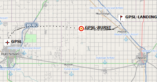
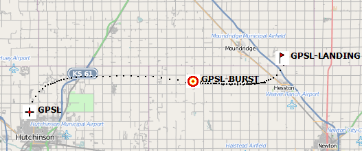
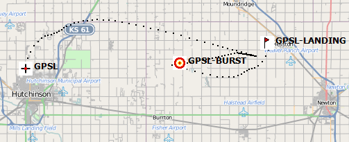
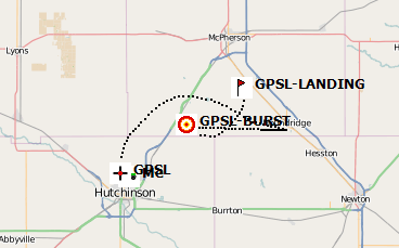
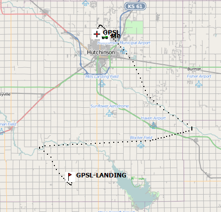
| Launch Site | Hutchinson (38.1010N, 97.9401W) primary, Moundridge or Sterling as alternates depending on wind forecasts. Monitor www.superlaunch.org for details. | |
| Capsule 1 (Track) |
ArduinoTrack with Radio Shack HTX-200 HT with vertically polarized dipole. Canon A570IS camera running CHDK. GoPro Hero pointed vertically. W0ZC-11. | 1.29kg |
| Capsule 2 (Track) |
Bill Brown's APRS Tracker. WB8ELK-11 | 0.28kg |
| Capsule 3 | Bill Brown's Iridium Modem beacon. | 0.28kg |
| Capsule 4 | Bill Brown's Find Me Spot beacon. | 0.23kg |
| Recovery / Misc |
Rocketman Parachute (.20kg) and misc rigging (.15kg). | 0.35kg |
| Total Flight Weight | Total neck weight on the balloon. | 2.43kg |
| Balloon / Gas | 1200g Kaymont with 5.6cu meters Hydrogen. 2.2m diameter. Net lift (2.4kg) | |
| Estimated Burst Altitude | 30,480 MSL (100,000') | |
| Estimated Ascent Rate | 380 m/min (1250'/min) | |
| Estimated Descent Rate | 425 m/min (1400'/min) | |
| Chase Frequencies | 446.000MHz |
{2jtoolbox_content tabs id:3 title: Tracking Predictions}
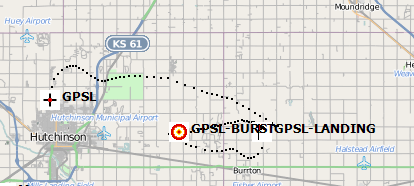
June 11
The hook back to the west is still gone, but winds are still light to moderate throughout the flight. Surface weather continues to look good although will be a bit breezy.
Unless there is a drastic change in weather by tomorrow, plan on a Hutchinson launch.
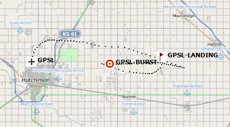
June 10
Surface weather is still looking favorable for Saturday morning with temperatures around 70F. Tracks have mostely stablized to an east-northeast at ~30 miles, depending on the flight parameters. The only difference I'm seeing today is a lack of a hook back to the west at upper levels.
Central Kansas has had a lot of rain over the past two weeks, so expect field conditions to be damp and muddy.
June 9
Same eastern track. The weather forecasts are showing minimal chance of rain over the Friday-Saturday period, and surface winds in the 10-20mph range. Mid-day temperatures are forecast to be in the upper 80'sF.
June 8
The winds are picking up just a little bit, but still tracking east.
June 7
Continuing the same pattern of an easterly track.
June 6
We're getting close enough for me to flip over to the GFS192 modeling. The track is very similar to the June 4th prediction, only slightly shorter. A Hutch launch is looking promising.
June 4
The forecasts continue to be all over the board. Today it is pushing the flight east-southeast towards (but not as far as) Newton.
June 2
Predictions have shifted by almost 180 degrees over the past two days. Yesterday's prediction which I didn't save, pushed the flight southeast towards Wichita/Eldorado.
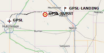
May 30
Initial predictions are encouraging for a launch from Hutchinson. A water landing in Cheney would be a concern, but otherwise looks good.
{2jtoolbox_content tabs id:3 title: Flight Results}
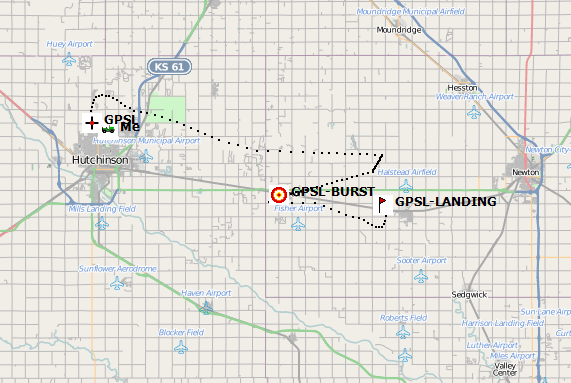
| Launch Date/Time | Saturday June 14th, 2014 at 8:15am (13:15UTC) |
| Launch Site | Crossroads Christian Church in Hutchinson, KS. (38.1015, -97.9399) |
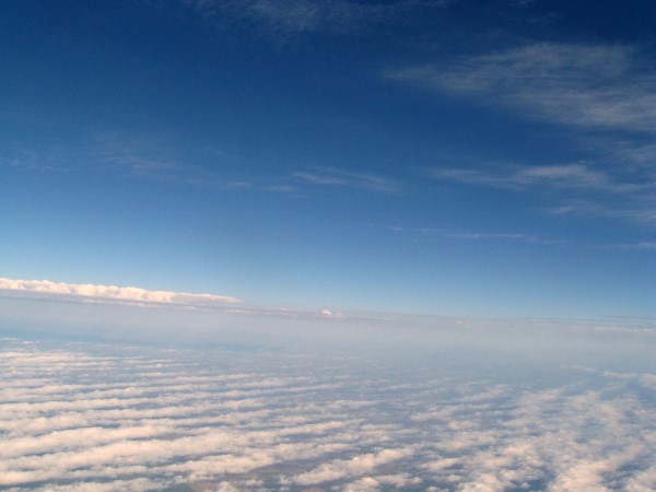
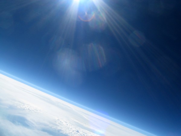
| Burst Altitude | 31,083m MSL (101,979') |
| Average Ascent Rate | 329m/min (1080'/min) |
| Measured Descent Rate | 488m/min (1600'/min) with parachute fully opened |
| Touchdown Site | 38.516333, -97.384167 |
| Touchdown Time | Saturday June 14th, 2014 at 10:26am (15:26UTC) |
| Recovery Time | Saturday June 14th, 2014 at 11:35 (16:35UTC) |
| Distance Traveled | 67km (42 miles) as the crow flies |
| Total Flight Time | 2 hours, 16 minutes |
| Downloads | APRS Log |
{2jtoolbox_content tabs id:3 title: Photo Highlights}
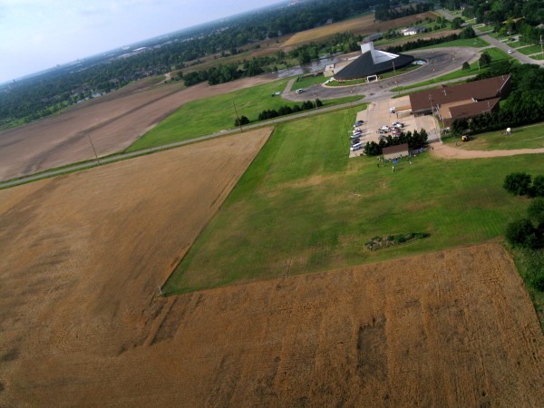
Just after lift off from Crossroads Christian Church.
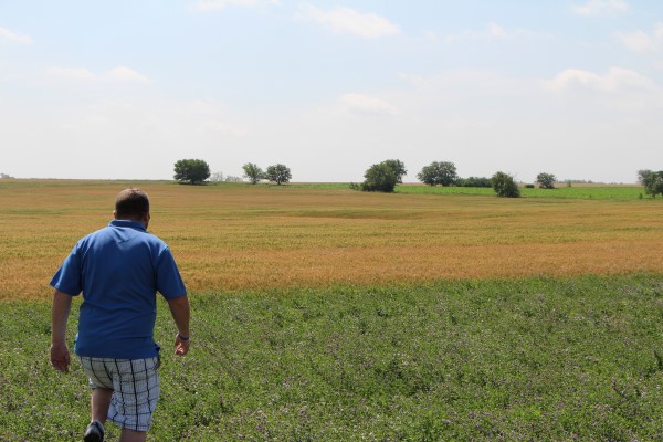
Ryan from Kaymont Balloons searching the field for the payload.
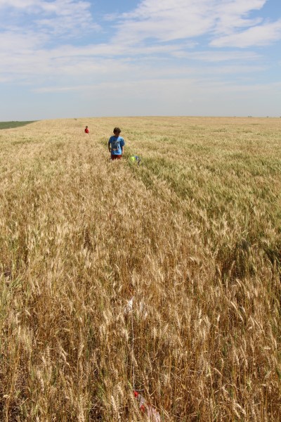
It's hiding in there.
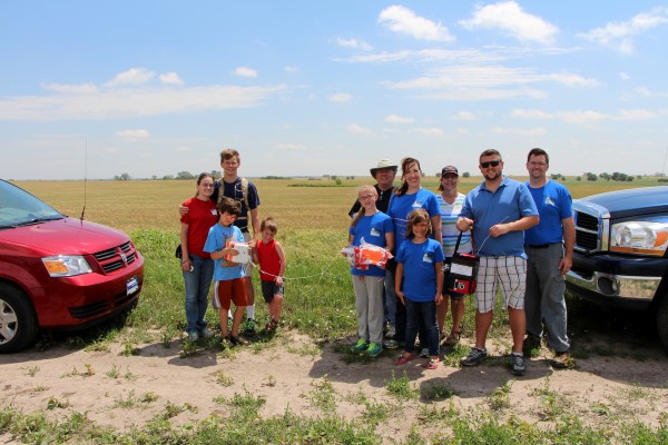
Jerry and Darcie met us at the recovery point.
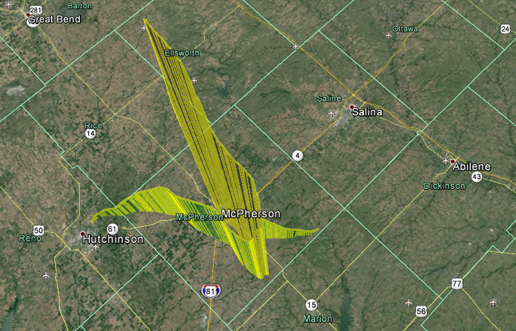
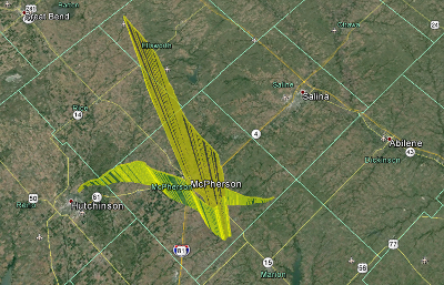
A Google Earth view of the flight.
More photos can be found in the Photo Gallery, Flight 2014a.
{2jtoolbox_content tabs id:3 end}