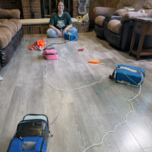
Flight 44 will be another experimental flight, to build flight hours on the latest version of the ptSolar tracker, as well as the newly redesigned ptFlex trackers.
There may also be a Horus weather sonde tracker going up on the string as well.
Flight Parameters
Launch Date/Time | Sunday August 24, 2025 at 8:00am (13:00Z) |
|
Alternative Date | n/a | |
Launch Site | K14 and Pretty Prairie Rd |
|
Alternate Launch Site | Rice Park in Hutchinson, KS |
|
Capsule 1 (Track) | Tracker: Battery powered ptSolar signing W0ZC-9
Tracker: Meshtastic from Travis, W0ECO Sensors: n/a Beaconing: Low Power
Cameras:
| 0.35kg |
Capsule 2 (Track) | Tracker: 3.7V (directly) powered ptSolar signing W0ZC-10
Sensors: n/a Beaconing: Low-Power Delay
Cameras: n/a | 0.13kg |
Capsule 3 (Track) | Tracker: ptFlex tracker signing W0ZC-11
Sensors: BME280 - temperature and barometric pressure. Beaconing:
Cameras: n/a | 0.24kg |
Capsule 4 (Track) | Tracker: ptFlex tracker signing W0ZC-12
Sensors: BME280 - temperature and barometric pressure. Beaconing:
Cameras: n/a | 0.35kg |
Capsule 5 (Track) | Tracker: ptFlex tracker signing W0ZC-13
Sensors: BME280 - temperature and barometric pressure. Beaconing:
Cameras:
| 0.70kg |
Capsule 6 | Tracker: Horus RS41 tracker signing W0ZC
| 0.10kg |
Recovery / Misc | Parachute and misc rigging. | 0.30kg |
Flight Weight | Total neck weight on balloon. | 2.17kg |
Balloon / Gas | 1200g Kaymont with 4.2cu meters of Hydrogen.
|
|
Estimated Burst Altitude | 31,300m MSL (102,700') |
|
Estimated Ascent Rate | 5.1m/s (1,000'/min) |
|
Estimated Descent Rate | 5.3m/s (1,040'/min) velocity at touch-down. |
|
Chase Frequencies | 446.100MHz |
|
NOTAM Filed | High Altitude Balloon from 37.7778N, -97.9375W. Southeast bound reaching Flight Level 600 from August 24 from 1300Z to 1600Z. (HUT08/026) |
|
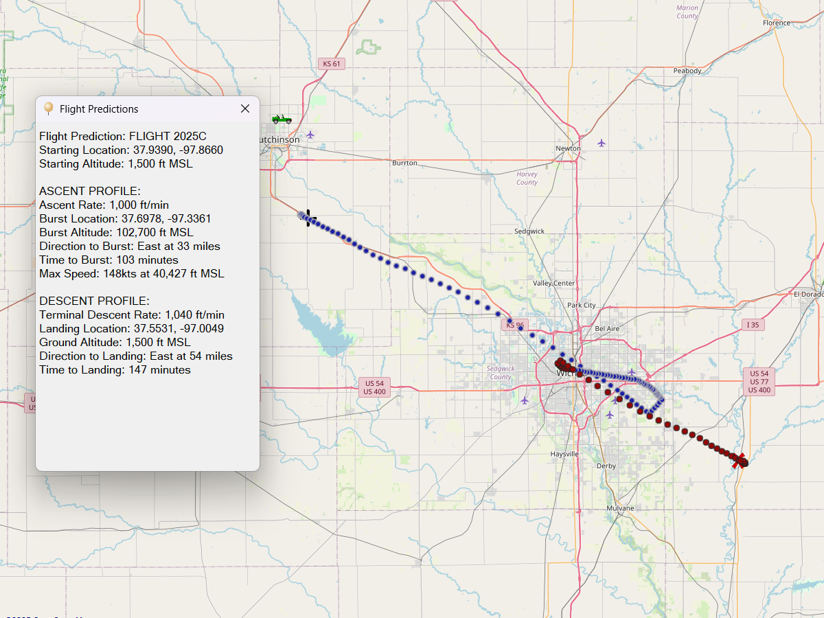
Flight Predictions
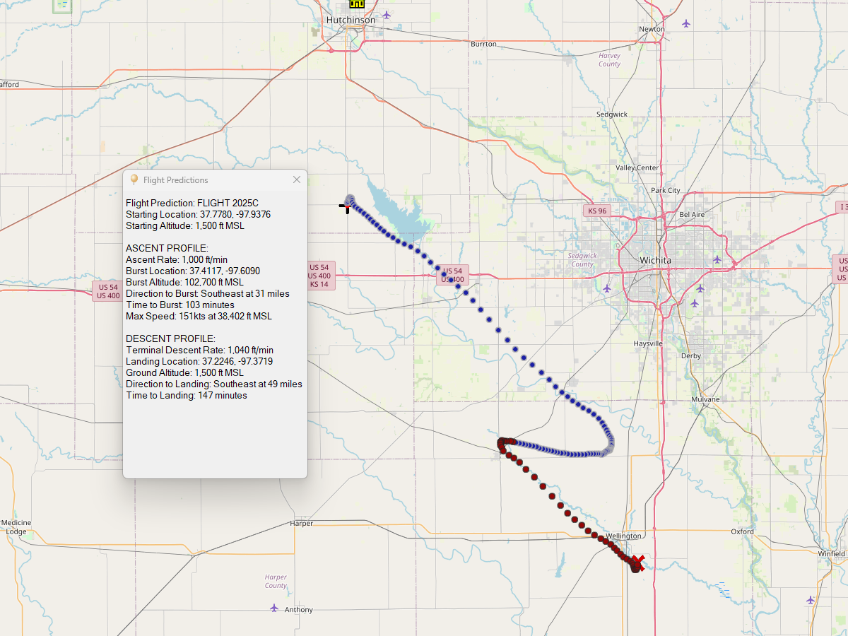
August 23, 2025
Todays forecast is staying consistent, with a forecast landing around Wellington, KS.
To avoid the city and the airports, we'll be moving the launch site to a small parking lot off of K14 and Pretty Prairie Rd. This is just a few miles west of Cheney Lake.
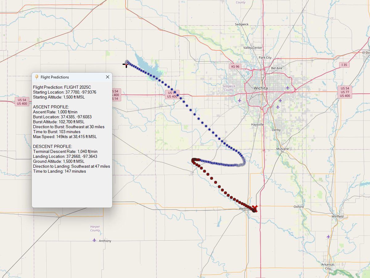
August 22, 2025
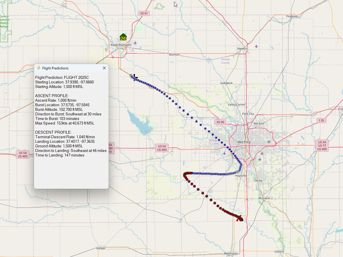
It's shifting back towards Wichita even with a Hutchinson launch site.
I've located a launch site near Cheney Lake that will push the flight well away from the city. I'll see how predictions look in the morning, and make the final call on Saturday.
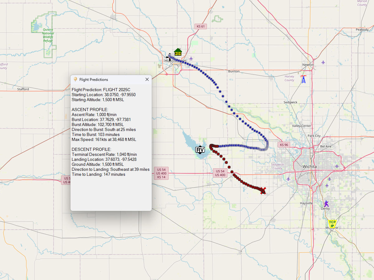
August 21, 2025
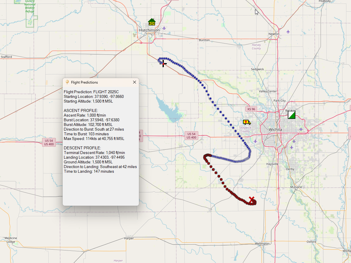
The overall flight pulled back down to 39mi to the southeast, which should clear any part of the Wichita metro area.
If these projections hold, we'll plan on launching from the backup launch site on the west side of Hutchinson.
August 20, 2025
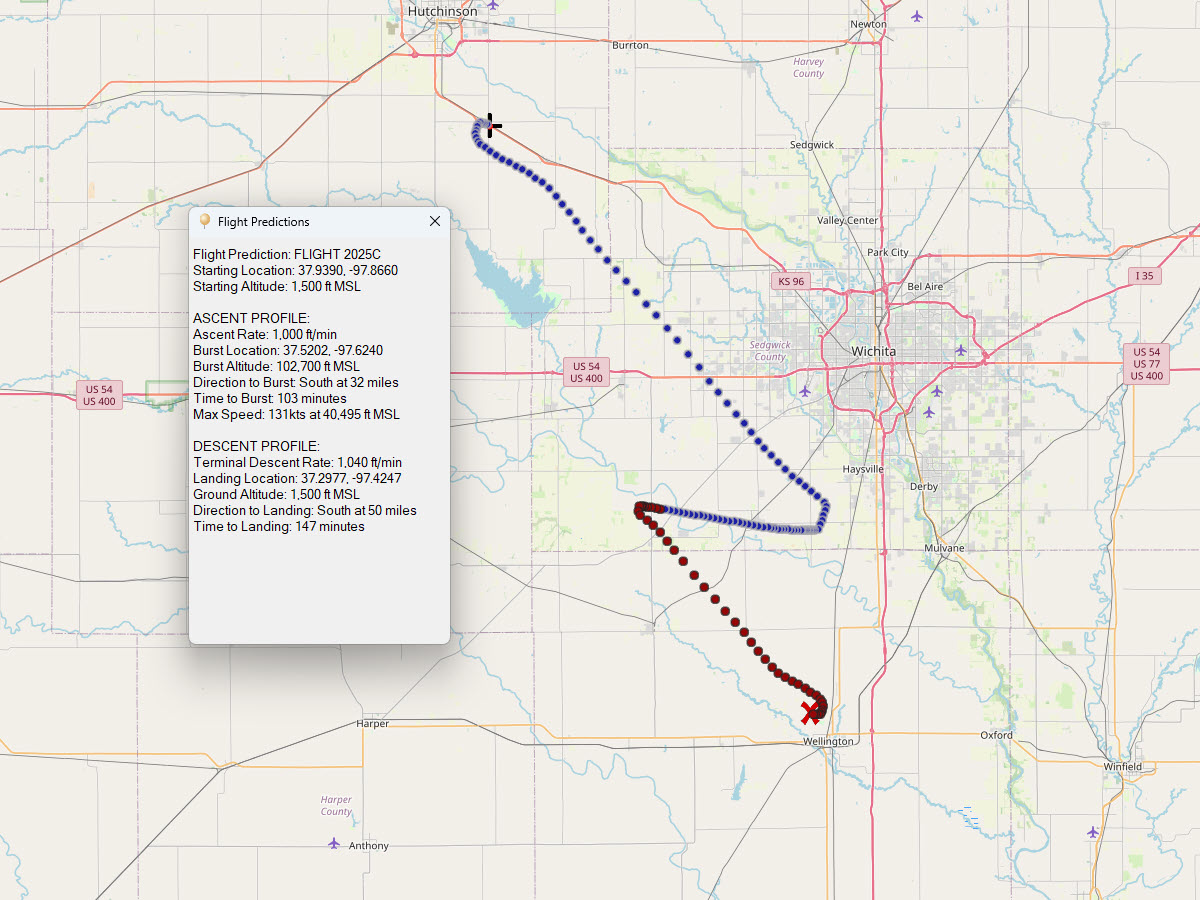
We're back to heading south again away from the city. We'll be picking up a pretty good tailwind of 131 knots right around 40k'.
Total flight is 50 miles to the south, which means we'll need to leave the launch site immediately to get out ahead of the landing.
August 19, 2025
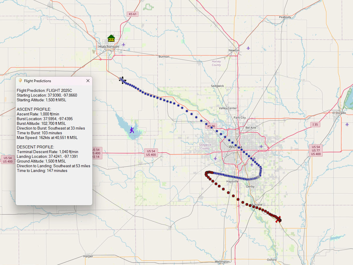
It's pulling a little bit further north, back towards Wichita. While the landing zone looks good, the flight path isn't optimal. I'll be exploring alternative launch sites, possibly from either Cheney or Newton areas to avoid the metro.
The surface forecasts had been calling for rain throughout the morning on Sunday, but that's currently pushed back until afternoon at least, and then minimal chance.
August 18, 2025
Very similar to yesterday's prediction.
August 17, 2025
Today's prediction shifted the flight path comfortably south of the Wichita area.
August 15, 2025
The initial prediction puts the flight directly over the top of Wichita if we used the Yoder launch site. A Hutchinson site would just pull the landing location closer to the city.