After a short break, it's time for Project: Traveler to get back in the air. This should be a short flight, testing a tripple balloon configuration.
| Flight Parameters | |
|---|---|
| Launch Date/Time | Sunday, 15 May at 9:00am |
| Alternative Date | None |
| Launch Site | Wells Aircraft at the Hutchinson Airport (38° 03.8', 97° 51.9'W) in Hutchinson, KS |
| Primary Transmitter / Antenna | VX-1R HT running APRS on 144.39MHz / Vertically polarized dipole |
| Backup Transmitter / Antenna | PocketTracker running APRS (AJ0NR-11) on 144.39MHz / Horizontally polarized dipole |
| Balloon / Gas | 3 x Kaysam 350gram / 60 cu feet of Helium each |
| Estimated Burst Altitude | 92,000' MSL |
| Estimated Ascent Rate | 1000' per minute |
| Estimated Descent Rate | Approx. 900' per minute at touchdown |
| Capsule(s) weight | 3lbs 5oz including parachute, rigging, batteries, etc... |
| Chase Frequencies | 446.52MHz |
| Balloon Finder Telemetry Mode | PT Mode 2. |
Flight Predictions
| Flight Predictions | ||||||
|---|---|---|---|---|---|---|
| Date Created (Central Time) | Dist From Launch | Bearing From Launch | Relative Position | Max Speed | Map | Winds |
| 8 May 9:15pm |
38mi | 118° (SW) | 5mi E of Park City | 49mph | Map | Winds |
| 10 May 9:30pm |
51mi | 127° (SW) | 5mi N of Rose Hill | 49mph | Map | Winds |
| 12 May 9:30pm |
81mi | 130° (SW) | 15mi E-NE of Winfield | 60mph | Map | Winds |
| 14 May 12:00pm | 62mi | 116° (SW) | 5mi E of Augusta | 65mph | Map | Winds |
| 14 May 10:15pm | 65mi | 118° (SW) | 12mi SE of Augusta | 60mph | Map | Winds |
Flight Results
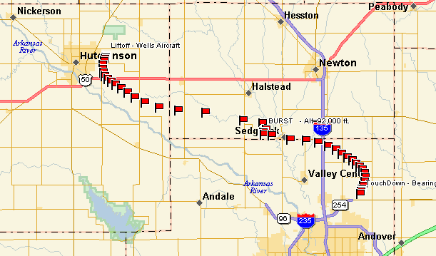
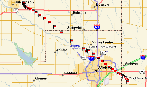
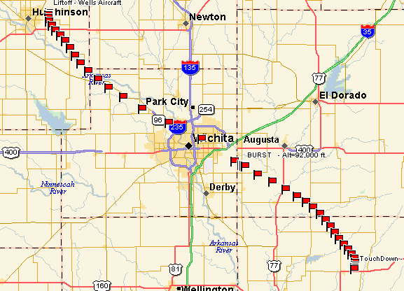
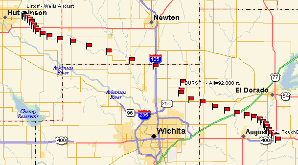
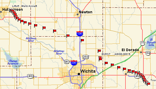
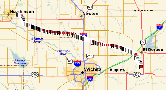
After another night of rain storms, the sky cleared off and a small group of us gathered at our normal launch site in Hutchinson. The primary mission objective was to fly the new Garmin GPS-18 above 60,000 feet
| Flight Statistics | |
|---|---|
| Launch Date/Time | Sunday, 15 May 2005 at 9:29am |
| Launch Site | Wells Aircraft at the Hutchinson Municipal Airport (38° 03.8', 97° 51.9'W) in Hutchinson, KS |
| Burst Altitude | About 67,810 (20,669m) MSL |
| Average Ascent Rate | 1070ft/min (5.44m/s) |
| Measured Descent Rate | 959ft/min (4.87m/s) |
| Touchdown Site | 5 miles east-northeast of Augusta, KS (37° 42.6976'N, 96° 52.5366'W) |
| Touchdown Time | Sunday, 15 May 2005 at 11:09am |
| Recovery Time | Sunday, 15 May 2005 at 11:45am |
| Distance Traveled | 58 miles (95km) as the crow flies |
| Total Flight Time | 1 hours 40 minutes |
| Downloads | Lat/Lon File, Log File (W0WR-11), Log File (AJ0NR-11) |

Lessons Learned
- We had a problem with the cutdown control transmitter, and had to leave the cutdown board behind. The cause is still under investigation.