Flight #31 will be a joint venture of the Project: Traveler group, and a new group that is forming in Dodge City. This will be Dodge City's first launch, and they will be leaning on us to help providing tracking and recovery assistance.
{2jtoolbox_content tabs id:3 begin title: Flight Parameters}
| Launch Date/Time | Saturday October 10th at 12:00pm (17:00Z). Plan on meeting about 1 hour ahead of release. | |
| Alternative Date | n/a | |
| Launch Site | Grace Community Church in Dodge City (37.7882N, -100.0235W) | |
|
Capsule 1 (Track) 144.39MHz |
ArduinoTrack (Combined) with RadioMetrix 300mW transmitter and Ublox M8Q GPS, signing KE0FUL-11. Multiple cameras |
1.00kg |
|
Capsule 2 (Track) 144.39MHz |
ArduinoTrack with Radio Shack HTX-200 HT transmitter and Ublox M8Q GPS, signing W0ZC-11. Beaconing is altitude-based delay: Canon A570IS camera running CHDK. Sparkfun 434MHZ transmitter module, transmitting AM modulated RF on 433.895 +/- 10khz. The 434MHz beacon sends the W0ZC callsign every 5 seconds. |
0.96kg |
|
Capsule 3 (Track) 144.39MHz |
ArduinoTrack (Combined) with RadioMetrix 300mW transmitter and Ublox M8Q GPS, signing W0ZC-12. |
0.24kg |
| Recovery / Misc |
Parachute and misc rigging. | 0.35kg |
| Total Flight Weight | Total neck weight on the balloon. | 2.55kg |
| Balloon / Gas | 600g Kaymont with 4.8cu meters (170cu ft) Helium. Neck lift (4.3kg) / Net lift (1.7kg) | |
| Estimated Burst Altitude | 22,915m MSL (75,180') | |
| Estimated Ascent Rate | 5.3 m/s (1040'/min) | |
| Estimated Descent Rate | 7.1 m/s (1400'/min) | |
| Chase Frequencies | 446.100MHz |
{2jtoolbox_content tabs id:3 title: Tracking Predictions}
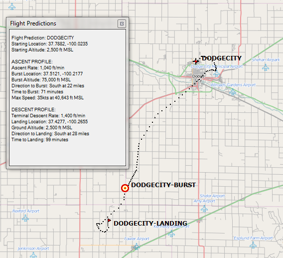
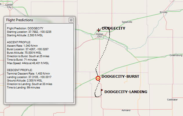
October 9
Today's forecast hooks back to the west slightly. The surface level winds continue to look moderate, but workable for Saturday's filling process.
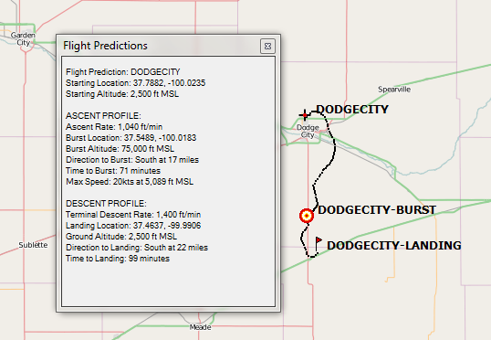
October 7
The predictions are still tracking south, but the winds are getting lighter each day. If the balloon does push farther south, recovery could get interesting as there appear to be a lot of ravines, and many of the roads do not go through. In that case, expect a pretty good hike.
October 6
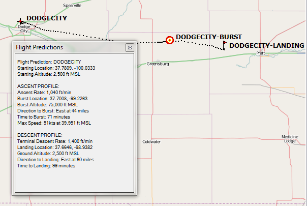
Consistent with the 5th's forecast. Surface weather looks to be nice with clear skies and moderate temperatures. The only problem is that surface winds will be out of the north at 16mph, gust 23.
October 5
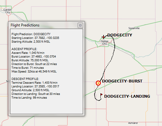
Today's forecast took a drastic turn to the south.
October 4
The winds have backed off significantly since last week's forecast, but are still generally easterly. Earlier today it showed about the same range, but with more of a southern component in it. This evening it's essentially due east.
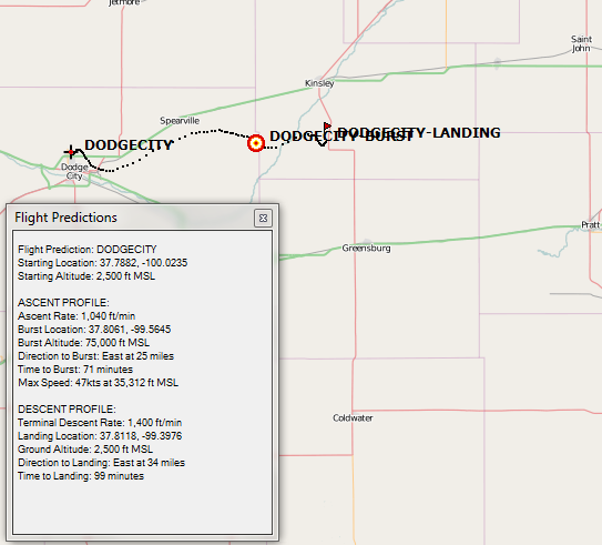
September 30
Initial flight predictions are showing a strong east component. Starting tomorrow we'll be within range of the more accurate GFS 0-240 sounding model, which should improve accuracy. Either way, the track looks very favorable for those traveling out from the Hutchinson area to chase.
The long-range surface weather forecasts look nice also, with light winds, moderate temps, and only slight chances of rain.
{2jtoolbox_content tabs id:3 title: Flight Results}
| Launch Date/Time | Saturday, October 10th at 12:25pm (17:25Z) |
| Launch Site | Grace Community Church in Dodge City (37.7882N, -100.0235W) |
| Burst Altitude | 31,299m MSL (91,875') |
| Average Ascent Rate | 4.66m/s (918'/min) |
| Measured Descent Rate | 8.05m/s (1,585'/min) measured at touchdown. |
| Touchdown Site | 37.4085N, 100.1225W |
| Touchdown Time | Saturday, October 10th at 2:32pm (19:32Z) |
| Recovery Time | Saturday, October 10th at 2:41pm (19:41Z) |
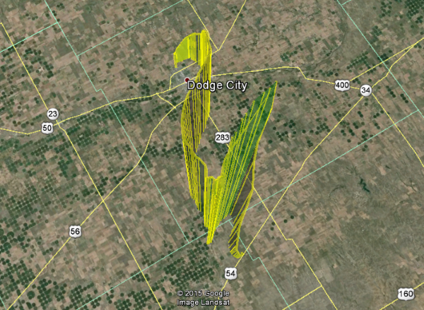
| Distance Traveled | 43km (27mi) |
| Total Flight Time | 2 hours, 7 minutes |
| Downloads | W0ZC-11 Log, W0ZC-12 Log, KE0FUL-11 Log, Flight Path (KML), Winds Aloft Forecast |
The Dodge City group had an excellent first flight. All of the equipment performed pretty much flawlessly, save for one errant GPS packet from the W0ZC-11 package.
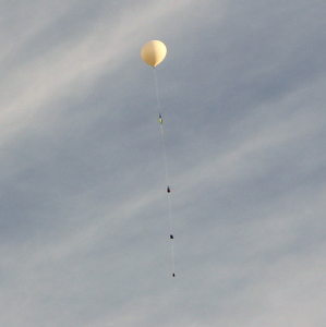
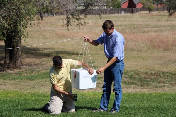
Dodge City's payload was in the white cooler and included an ArduinoTrack flight computer and two video cameras. Upon landing the cameras were knocked loose, but fortunately they stayed put for the duration of the flight. Tim reported that the battery one one of the camera gave out a mere minutes after recovering the package.
The W0ZC-12 package included a 19 inch counterpoise on the ground of the antenna port. After adding this second half of the transmitting antenna, our reception rate was excellent with the 300mW RadioMetrix transmitter.
{2jtoolbox_content tabs id:3 title: Photo Highlights}
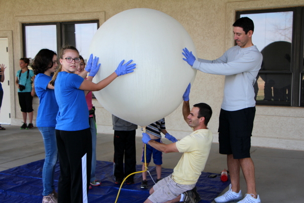
The church has a covered back porch with bays that are plenty big to pass an inflated balloon through (carefully). The porch provided excellent wind breaks for winds out of the south.
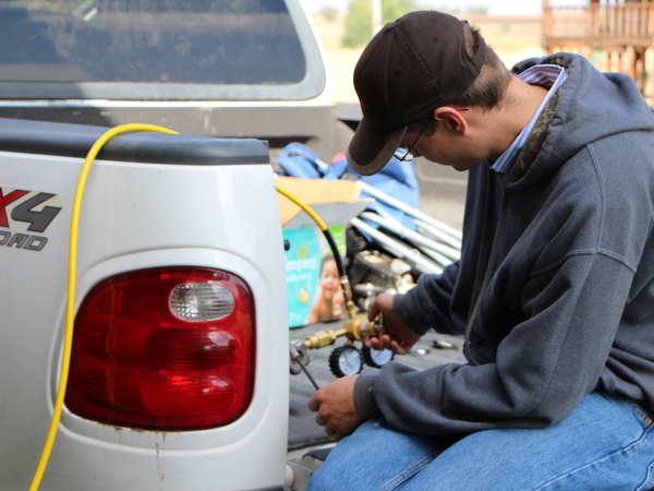
Andrew learned to run the regulator.
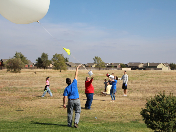
Saying goodbye to their baby.
More photos can be found in the Photo Gallery, Flight 2015f.
{2jtoolbox_content tabs id:3 end}